West-Estonian Lowland
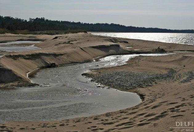
The Uuejõe river with its moving mouth at Nõva Landscape Protection Area
http://pilt.delfi.ee/picture/3147719/
The largest plain of most complex forms
Extends about 120 km in the north-south direction, from the coast of Moonsund to the coast of the Livonian Gulf, including islands and numerous islets
More than 510 km bordered by coastal zone
Younger than the High Estonia: terrestrialization began ab 9300 years ago
Since then land uplift 90 m in North - West, 55-65 m in the South
Formed during glaciation: abrasional heights and basins, later glacio-lacustral and marine plains, still later - mires
The plain is indented by the mound-like abraded till plains and varved clay glacio-lacustrine plains (near Matsalu, Haapsalu, Pärnu, Vändra, etc)
East-directional bays: Haapsalu and Matsalu
The bedrock: mostly Ordovician bioherm limestone of the Jaagarahu Stratum (riffs) and the Silurian Klint
Elevations (heights) of bioherm limestone at Koonga, Oidrema, Pärnu-Jaagupi
carbonate rock drumlin fields at Kirbla, Lihula, Soontagana
Coastal terraces, till plateaus: the Devon Pärnu Stage sandstone on limestone bedrock: Tõstamaa dunes
The Kasari river - with the biggest catchment area and big flood area
Coastal lakes, developed from bay-bights:
- a rich variety of meadows and extensive reedbeds
- rich variety of migratory waterfowl, meadow communities
- area of coastal meadows decreasing dramatically
Sparse settlement, especially in SW and SE
A number of recreational areas in addition to traditional agriculture and fishing
The only bigger city: Haapsalu
Matsalu National Park - on of the biggest waterfowl protection areas in Europe
Silma Landscape Protection Area - to protect the terrestrilizing bay as a waterfowl area
Nõva Landscape Protection Area - to protect coastal sand terraces and plains