Introduction
In principle, landscapes are parts of natural environment with different nature, use, and looks. Landscapes as geosystems differ in topography, waterbodies and vegetation.
Landscape regions comprise large relief forms, such as heights, lowlands, plateaus, depressions.
The development of modern landscapes of Estonia began after the retreat of continental ice sheet, glacial meltwaters and the sea that once covered nearly 2/3 of the territory.
In times, the thickness of the continental ice sheet exceeded one kilometre, and its weight made the crust sink.
Later, the Earth`s crust was released from the weight of the ice cover, and started to rise, especially rapidly in North Estonia. Currently the land uplift is about 3 mm a year. The southwestern coast of Lake Peipsi is sinking about 1mm a year.
In conclusion, the glaciers of the Baltic Sea and Lake Peipsi together with smaller glaciers have played key roles in shaping the Estonian topography. The modern surface topography of Estonia has developed in Late and Post-glacial periods.
The present e-learning object touches upon 10 lowlands out of 25 landscape regions based on the geomorphological map and division by Ivar Arold, Institute of Geography, University of Tartu in his book „The Estonian Landscapes".
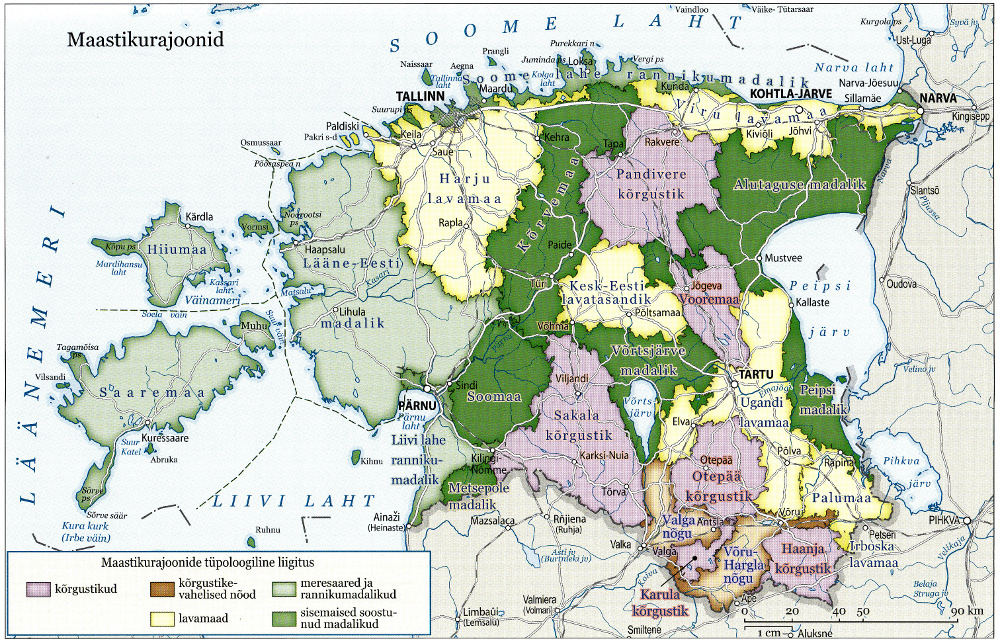
Landscape regions in Estonia by Ivar Arold
Source: Arold, I. Eesti maastikud.