Alutaguse Lowland
3345 km2
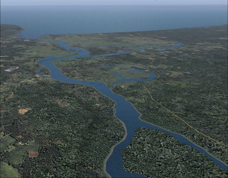
Braided tributary rivers - struugas - on the lower course of the Narva river
http://www.fs-estonia.de/Bilder/NarvaJogiM.jpg
Located in North-East Estonia, large area of wetlands and forests
The biggest wetland in Estonia - the Puhatu mire system
Topography: glacio-lacustrine plains and large mires, dunes
Internationally important Ramsar area
Iisaku - Illaku esker system
Kurtna kame field with numerous lakes
Kuremäe hill and nunnery
A low belt of dunes and old dunes (kriiva) on the north coast of Lake Peipsi
The biggest river by the volume discharged - the braided Narva river
Poruni virgin forest
Deciduous forests on bog islands and river valleys
Dune oak forests and dune communities
Open-cast mines of oil-shale, leveled gangue hills
Two power stations with ash lakes
Oru peat fields
Communities of Russian Orthodox Old Believers migrated in the 17.-18. cc.
Imprints of the mixed Estonian-Russian culture
Settlement concentrated to the north part: Narva, Kohtla-Järve
The biggest city Mustvee in the southern part
Recreation areas on the north coast of Lake Peipsi and around Kurtna
Protected areas occupy 16.4% of the region, mires belong to the list of Ramsar areas: Puhatu, Muraka, Endla landscape protection areas