Saaremaa
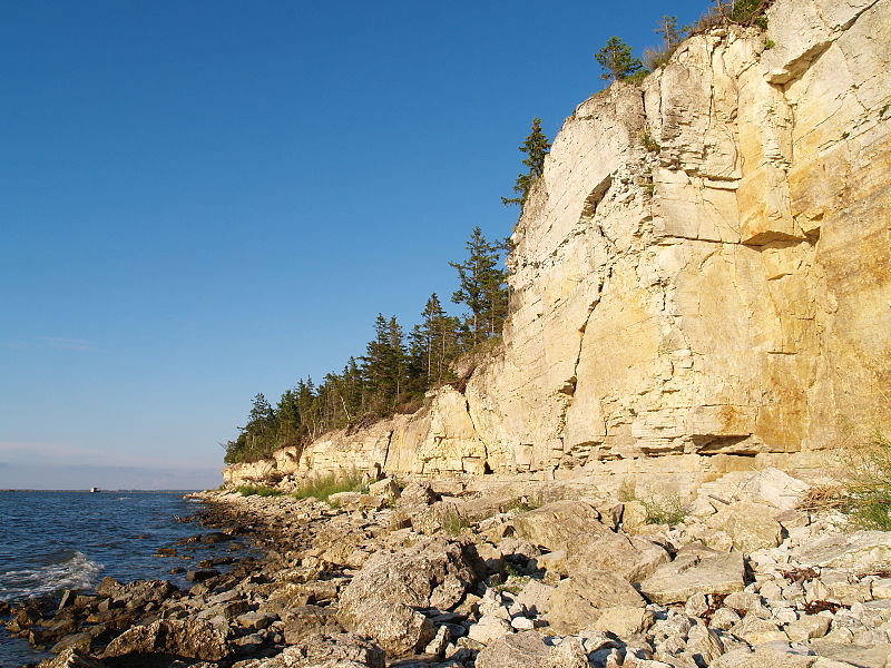
Kesselaiu limestone cliff is a part of the West-Estonian klint
http://et.wikipedia.org/wiki/Pilt:Kesselaiu_pank.JPG
The landscape region is formed of the biggest island Saaremaa and 710 smaller islets around it (e.g. Vesitükimaa, Linnusitamaa, etc)
Saaremaa and Muhu islands are connected by the dam road
Formed during the different stages of the Baltic sea, by the waves and winds
Islets are mostly limestone heights, abraded by glacial flow and waves
Thin Quaternary cover
Coastal rocks of bioherm limestone - West-Estonian klint (Panga cliff, Üügu cliff, etc)
West-Saaremaa Upland and Sõrve peninsula as a glacial edge formations
Topography: washed limestone and till plains, capes and small bays, bays or abraded plains developed into paludified meadows and forests; coastal meadows ; shallow lakes as a result of land uplift; Mändjala dune ridges, Kaali meteorite crater
Juniper thickets, pine, spruce and oak forests; broadleaf elm-maple-lime forest on Abruka island
The biggest city: Kuressaare with 70% of the popluation of the island
Vilsandi National Park - to protect marine and coastal communities
Kaugatoma-Lõo Landscape Protection area - to protect alvar communities
Viidumäe Nature Protection Area - to protect unique habitats (e.g. Rhinanthus osiliensis)