Viru Plateau
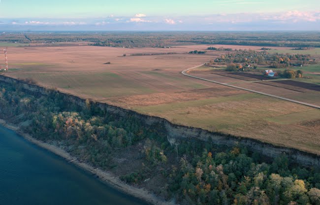
South of the klint terrace there is Viru plateau
http://victoriagailevskaja.blogspot.com/2010_05_01_archive.html
The eastern part of the Harju-Viru Ordovician limestone plateau between the Coastal Lowland and Alutaguse
Exposing bedrock with thin Quternary moraine cover of 1-2 m, rich in limestone
The biggest natural form is the klint (Baltic klint) in the North
Maximum height (56 m) and the best bedrock denudation at Saka-Toila-Ontika
Bedrock rich in natural resources: phosphorite and oilshale of the Kukruse stage of limestones (kukersite - first test mining at the Kukruse manor estate in 1916)
Man-made technological landscapes: open mines, terricones, ash cones, ash plateaus, non-cultivated old mines, waste cones
Few esker systems and erratic hills, e.g. Sinimäed hills
Deep primeval valleys of the Purtse, Pühajõe, Voka and Sõtke rivers
Descending the klint terrace the rivers form falls or cascades, e.g. the Valaste fall of 26 m
The terraces of the Narva river are mostly dry because the Narva Power Plant
Karst features, e.g. Uhaku karst field
Remarkably damaged natural communities around the cities
Newly re-cultivated and re-forested old open mines around Aidu and Viivikonna
Most urbanised region in Estonia,with big industrial cities, especially in the eastern part
Bigger cities: Narva, Sillamäe, Kohtla-Järve, Püssi, Kiviõli
Ontika Landscape Protection Area to protect the highest part of the klint, the highest fall and klint forest
The Narve River Canion Landscape Protection Area