Harju Plateau
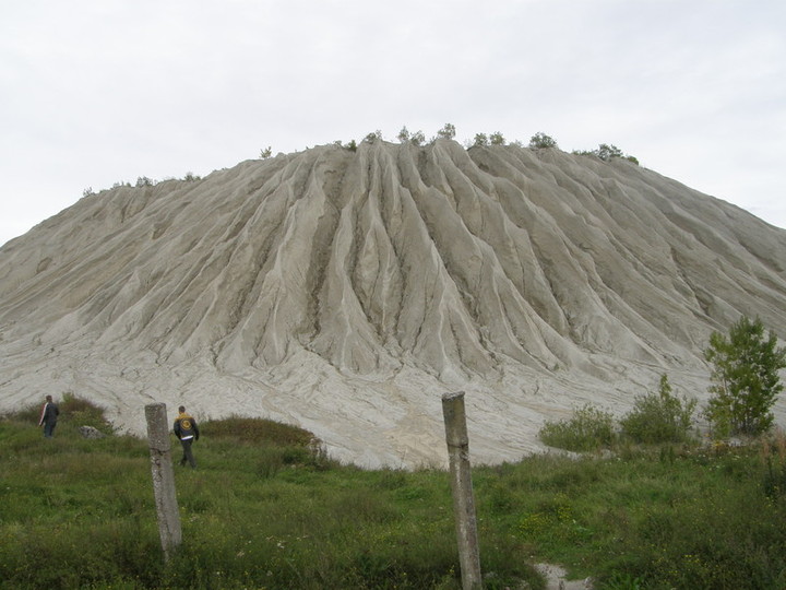
Rummu gritstone cone of anthropogenic origin
http://nagi.ee/photos/photo_sizes.php?id=2082569&size=l
Plateau of limestone bedrock in North-West Estonia, bordered by the klint and including the Väike-Pakri, Suur-Pakri and Osmussaar islands
Thin Quarternary cover, almost exposing the abraded tectonically fissured limestone bedrock
Bedrock layers visible on the lower courses of the rivers on the klint terraces
Alvar communities, moraine plains with deciduous forests, moraine arable fields
Troughs (synclinal valleys) intersect the plateau into smaller units
In abraded depressions there are mires as a result of the overgrowth of old lakes - 20.5% of the plateau area, e.g. Mahtra mire system and Harku, Pääsküla, Valdeku and Rae bogs around Tallinn
Numerous karst features: Tuhala, Kostivere, Kuimetsa
Virulase karst cave with the longest main gallery of 58 m, other galleries of 90 m
Man-made technological landscapes at Rummu: gritstone cones
Most of the rivers start from the mires, flowing in troughs and forming falls, cascades or rapids on the klint: the Jägala, Jõelähtme, Pirita, Vääna, Keila rivers
The hidden 2-km Kuivajõgi river (a tributary of the Pirita river)
Sae-Paunküla channel to link the Pirita and Jägala rivers; Vaskjala channel to link the Pirita river and Ülemiste lake
Only a few lakes: Ülemiste (985 ha), Maardu and Klooga lakes
Ülemiste lake as a water reservoir for Tallinn
Dense settlement: in and around Tallinn there live ab 1/3 of the Estonian population
Green belt around Tallinn: Kloogaranna, Laulasmaa, Keila-Joa, Kiisa
Other bigger cities: Keila, Paldiski, Saue, Maardu, Rapla, Kehra