Ugandi Plateau
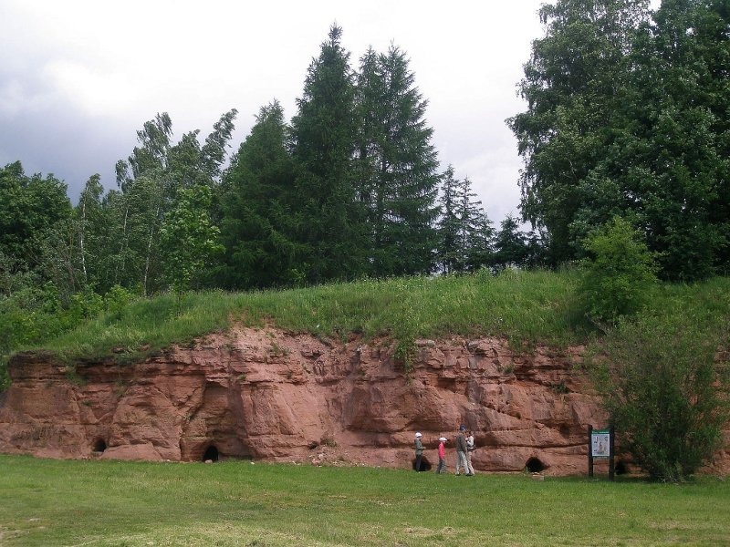
The Graveyard denudation in Tartu: the Aruküla stratus of the Middle-Devonian sandstone in the primeval valley of the Emajõgi river
http://pilt.delfi.ee/en/picture/6845117/
Located on the sandstone bedrock between Peipsi and Võrtsjärve lakes
Borders with Vooremaa in the North, Otepää Height in the South, and Palumaa in South-East
Plains with reddish-brown non-calcareous moraine, easily abrading sandstones
Devonian sandstone denudations at Kallaste near Peipsi lake and at Tamme near Võrtsjärve lake; also on the river banks of the Ahja and Võhandu primeval valleys
Deep buried primeval valleys, filled with Quaternary sediments, their valley beds below the sea level
In partly buried valleys there are rivers (Emajõgi, Ahja, Elva, Alatskivi, Kavilda) or lakes (Verevi, Viisjaagu, Vissi)
Moraine plains with rolling landscape near Elva-Vitipalu, Vara, Rannu and Valguta
Drumlins on the east coast of Võrtsjärve lake
Hilly kame fields near Vellavere and Kambja
The highest form of kame fields is Vooremägi hill of 123 m at Haaslava
Mires in valleys and in abrasional basins of glaciers
Moraine landscapes mostly cultivated
Spruce forests in valleys and on plains (in the east), pine forests on sandy soils
Floodplain communities
Bigger cities: Tartu, Elva, Kallaste, Põlva, also rural cities Alatskivi, Luunja, Puhja
Protedted areas rather small, mostly to protect valleys with natural communities:
The Ahja River Primeval Valley Nature Protection Area;
Elva-Vitipalu Landscape Protection Area