Palumaa Plateau
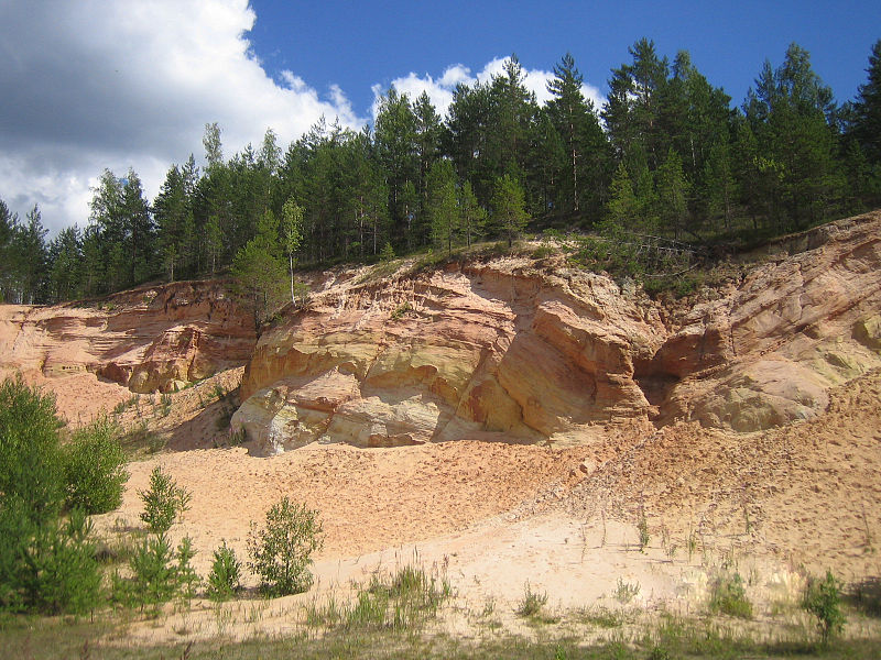
Landscapes at Piusa
http://en.wikipedia.org/wiki/File:Piusa_sand_quarry_3.JPG
The name introduced by the geography professor of Tartu University, J.G. Granö in 1922
Located south of the Ugandi Plateau
Landscape rich in forests: mainly dry boreal pine forests and boreal heaths
Devonian sandstone denudations at high river banks
In the meander of the Piusa river - dune sands and sand mines to mine the Gauja stratum sandstone for producing colour glass
Piusa sand cave system with 10 km of galleries (undergorund mining) and the biggest hibernation are of bats in the Baltic area
The longest river of Estonia - Võhandu - flowing on the western border of the plateau
Sandstone denudations, called „walls", on the Võhandu river
Meenikunno bog - the overgrowth of the previous lake
Ilumetsa meteorite craters
Nohipalu Valgjärv lake with the clearest and the most mineral poor water
Nohipalu Mustjärv lake with the most fast-warming water in Estonia
Settlement: sparse on forest areas, more dense on cultivated areas
The biggest city: Räpina
Meenikunno Bog Landscape Protection Area, Mustoja Kame Field Landscape Protection Area, Piusa Sand Caves Nature Protection Area